Pages

Showing posts with label 4-wheel drive. Show all posts

Friday, December 31, 2010

52 week tour Down-Under Western Australia

Thank you for stopping by my blog. As an introduction below is a photo of your hosts - your tour guide - myself, my driver and tripod and sustenance bearer - my husband Rod, and my son Mark - who travels with us with good humour even when his mother stops to photograph yet another wildflower! (well sometimes with good humour...LOL....)

Without them I would have never travelled around my wonderful state Western Australia and been able to bring these photos to you. I thank them for their support. There is so much to show you - from beautiful coastlines, to towering forests, shady pathways and river banks, to desert vistas, rugged gorges, gorgeous wildflowers, and beautiful sunsets.

When I decided to do a 52 week project, I thought about all the wonderful photos I had seen on DPS from people all over the world and I decided I wanted to share my corner of the world, Western Australia with you. I live in a truly remarkable state where you can go from oceans, to mountains, streams and gorges, rolling hills and deserts. We have it all. And I love every part of its infinite beauty.

As much as I would like to take a year off work and go touring - that might have to wait till I retire. Western Australia is huge, and as I thought about how I could possibly bring this tour to you, I realised that we had travelled over a lot of Western Australia over the last few years. So I wrote down a plan of how to travel around my State in a logical manner, starting from our capital Perth, then travelling south, then through the middle to the north and back down the coast. To cover all this ground would indeed take many months. So the photos you will see are not all new, but 90% of them have been taken in the last few years. The Kimberley leg for instance were all taken during our trip in 2009. So some photos are from my archives of thousands of photos, and some are new this year as we travel to places new to us, or we have revisited some places to bring you new photos.

I hope you enjoy the ride as I take you around Western Australia. Start from week 1 in January and work onwards through the year to December.  I hope to "see" you along the track. I'll make sure the billy is boiling and the damper is on the fire cooking!  Make sure you bring the marshmallows!


 and for a sneak preview of what is to come ...........


I will be updating these posts from time to time with new images and info. So drop back and see me sometime. I look forward to seeing you up the track! Want to send me a message - drop a comment in the "comments" box at the end of any post  - I look forward to hearing from you!

Of course our touring doesn't finish here - we are constantly looking for new places to visit - so if you are interested in checking out more articles about Western Australia on my blog? click here - Life Images by Jill or for my latest photos visit me at Flickr - Life Images by Jill on Flickr

Looking forward to seeing you on the road somewhere!


Sunday, December 26, 2010

Week 52/52 - Great Central Road - and onwards to the border - Western Australia

Well hello everyone and welcome to Week 52 of 52 - of my Tour Downunder Western Australia. Yes it is the last week! I can hardly believe that I have taken you for 52 weeks around my magnificent state where I live - Western Australia. I have enjoyed bringing you photos from my travels around my state and I hope you have enjoyed seeing my corner of the world.

For all of those who have come along for the ride, and taken the time to look and comment, I thank you very sincerely. I have enjoyed immensely having you along and reading your comments. You gave me the enthusiasm to continue the 52 weeks of posts, so I thank you.

This week we continue eastward over country new to us. We are travelling on part of The Great Central Road - which is also known as The Outback Way - and - Australia's Greatest Shortcut - a series of roads which connect to travel 2750 kilometres right through the centre of Australia from Laverton in the middle of Western Australia, across the Northern Territory to Winton in the middle of Queensland, taking you through spectacular country . It is very interesting to see the changes in landscape and the 10 different bio-regions featuring their unique flora, fauna, geological and landscapes - sand ridges, deserts, mountain ranges, sand plains. The road is well maintained, and information panels along the way are interesting to read. A map is essential so you know where you are, and there is a touring atlas of the road which as well as containing maps, distances etc, has a wealth of information to assist in your enjoyment of your trip!

For this part of the journey we will be continuing east from our last camp at Niagra Dam to Laverton, and we will be camping out in the bush for three nights before we reach the Northern Territory border (as it will take us 3 days to get to the border!)

As you will see from the photos this section of the road is gravel, which we found to be in very good condition. This is remote country, although you will meet other travellers doing the same crossing and there are a few small towns, aboriginal communities, road houses and pastoral stations along the route, so you need to be well prepared for remote travel. Look out for road trains (be careful of the huge dust cloud they throw up reducing visibility to zero! - I'll show you a pic later), as well as wild camels, dingos and kangaroos. - keep your eyes open to see them!

This is a photo of my son's vehicle coming towards us. They travelled with us for this part of the trip.

From Western Australia

Late afternoon at my son's camp site at what we called Desert Oakes camp. The Desert Oakes are actually not an oak at all but a type of Casuarina.

From Western Australia

The wide dry sandy bed of Giles Creek, lined by river gums, near Desert Oakes camp. I like the painted look of this photo.

From Western Australia

Early morning low rain cloud over the Petermann Ranges near the Western Australia/Northern Territory border.

From Western Australia

Spinifex heads in the late afternoon light..........spinifex is a common plant in the desert regions of Australia.

From Wildflowers

another road shot taken through the front windscreen as we drove along - the dust in front is from my son's vehicle...... (can't always stop to take a photo LOL)


From Western Australia

You actually see a lot of these along the road side - old cars that have broken down, been stripped of their tyres and engines and whatever else can come off, and left to rust on the road side.

From Western Australia

When we are travelling for several days, and camp out in the bush there are no facilities like showers and toilets.....you find a bush to squat behind. But we do carry our shower tent, and a solar shower (a bag you put water in basically) so that we can have a shower every couple of days. Amazing how refreshed and clean you can feel from 1 or 2 litres of water....

From Western Australia

A road train......the only thing you can do when you meet one of these is to move over to the side of the road and wait for the dust to settle....visibility is zero!

From Western Australia

A wild camel on the edge of the road - unfortunately I was looking straight into the sun when I took this photo, but I wasn't going to get out of the car to try and get a better angle!

From Western Australia


This is sunrise at Yarla camp - I climbed to the top of the breakaway up from our camp to take this photo. Scenes like these and the peace you get when you are camping "out bush" are what I love about travelling around Western Australia.

From Western Australia

Thanks again everyone for looking, and for your support throughout the last 52 weeks. I hope you have enjoyed the tour. I look forward to hearing from you.

Sunday, December 19, 2010

Week 51/52 - Golden Quest Disovery Trail - red dirt and gold fields - Niagra Dam

Hi everyone and welcome to Week 51 of our 52 week Tour Downunder Western Australia. We are nearly to the end of our journey, and this week we head north from Kalgoorlie and into more of the gold mining areas.

From Kalgoorlie you can do the goldfields Golden Quest Discovery Trail, a 965 loop which takes you through some of the history and landscapes of the goldfields.

Here we are on the road.....


From Western Australia

And here we are in Menzies. Below is a photo of the Council Offices. Completed in 1896 the clock tower remained "clockless" for one hundred years despite being built to overcome the locals confusion about the "real time". The clock was finally installed in 1999.

From Western Australia

This is Lake Ballard - a huge salt lake - part of a number of salt lakes that follow the course of ancient river beds. An interesting feature of Lake Ballard is 51 statues that are spread out over one part of the Lake, installed in 2003 by British artist Antony Gormley for the Perth International Arts Festival. The lake is a hazardous environment, and visitors are warned to walk with someone else and that temperatures on the lake reach over 45 degrees Celsius (113F) in summer.

From Western Australia

Here is one of "out bush" pubs - Ora Banda, built in 1911 from local stone. And part of all that remains of the goldmining town of Ora Banda which had a population of 2000 in 1910.

From Western Australia

We visited the old townsite of Gwalia - Goldmining began here in 1897, but today Gwalia is essentially a ghost town, having been largely deserted since the main source of employment, the Sons of Gwalia gold mine, shut down in 1963 and the town became deserted virtually overnight. Residents from nearby Leonora keep the deserted buildings as a museum of sorts - you can wander about the old buildings and get a feel of what life was like in the old days.

Here is the old mechanics garage - the walls are adorned with vehicle number plates.

From Western Australia

And the old hotel.......

From Western Australia

A pressed metal wall inside one of the houses....

From Western Australia

Tonight we will camp at Niagra Dam - built in 1897 to service the nearby gold mining town of Niagra, the gold soon ran out, the town died, and the dam never reached its full potential due to unreliable rainfall, and a major source of fresh underground water was found near the new townsite of Kookynie.

It is a lovely place to camp, and several walk trails take you around the dam and amongst the breakaway seen here in this photo....

From Western Australia

here is our camp at Niagra Dam. You can see our car is a little dirty from the red dust roads.

From Western Australia
__________________

Friday, June 25, 2010

Week 26/52 - Yalgoo & Monsignor Hawes - entering the "outback"

Welcome everyone to week 26 of my 52 week tour Downunder Western Australia.

This week we official cross over into the "outback"

After visiting the Perenjori tourist bureau for a wildflower update, we continue north to Morawa. From here you can take the gravel Morawa-Yalgoo Road to Yalgoo or continue north on the bitumen to Mullewa.

We head towards Yalgoo and passing a sign which proudly announces we are now in “The Outback”, we enter station country, where yellow Silver Cassia, Grevilleas, Wattles and everlastings flower in bright contrast against the dark red dirt. In this photo you can see the road running straight ahead into the distance and the white everlastings lining the road.


From Life Images by Jill

Yalgoo, which is part of the Wool Wagon Pathway and the Miner’s Pathway, two of the Gascoyne Murchison Outback Pathways historic routes, was settled by prospectors in the early 1890’s. Many old mine sites and relics can be explored in the area, including Jokers Tunnel, a tunnel carved through solid rock by early gold prospectors. Rich in gold mining heritage, little remains of this once thriving town.

This is a photo of Yalgoo's entrance statement.

From Life Images by Jill

Yalgoo has a number of historic buildings including the tiny Dominican Chapel of St Hyacinth, which Monsignor John Hawes built for the Dominican Sisters in 1920 when he brought them to Yalgoo to run the school.

From Life Images by Jill

Remains of an old station homestead. Do you like the framing I've done in this photo?

From Life Images by Jill

I just love the north. The southern forests are so beautiful, but there is something special about that red dirt and the wide open spaces of the Pilbara and Kimberley.

I often think what a lonely life it must have been for those first settlers in the desolate outback. My grandmother included, who was taken out into the bush and expected to raise children in a hut with a dirt floor while my grandfather was away a lot of the time.

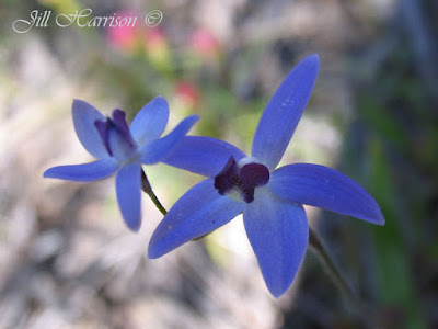
To get the most out of any wildflower drive, you should stop the car on the roadside verges or nature reserves and walk into the bush, as it gives you the opportunity to find flowers you won’t see travelling along the highway. Even areas which appear arid at first glance can reveal hidden treasures. We would have never seen the “Dainty Blue Orchid” (photo below) which we had never seen before if we hadn’t ventured off the road. Many flowers are more exquisite close up, and different soil types will produce different plant varieties. It is a good idea to photograph the flower, leaves and environment, or take notes, to assist with identification in a wildflower book later.


From Wildflowers
At Pindar, we turned north onto the Beringarra-Pindar Road towards Tallering Station. About ten kilometres along we found a large stretch of the unique Wreath Leschenaultia growing on the sandy road verge.

From Wildflowers

Back on the main road we continue to Mullewa, home of the greatest number of Monsignor Hawes’ religious buildings. The Church of Our Lady of Mount Carmel and the Holy Apostles St Peter and St Paul were built in the style of a Romanesque church typical of Italian or Spanish village churches. You can also visit the former home of Monsignor Hawes, now the Priest House museum.

From Life Images by Jill
Next week we will continue on to the historic gold town of Cue.

Friday, May 28, 2010

Week 22/52- Esperance - dazzling white sand & sparkling blue water

Hi everyone, welcome to Week 22 of our 52 week tour Down Under Western Australia.

This week we travel 107 kilometres south of our last destination (Peak Charles) to Esperance on Western Australia’s south coast, midway between WA's capital Perth and the South Australian border.

Isolated by distance, (721 kilometres, approximately a nine hour drive or one and a half hour flight south east of Perth) Esperance has retained a laid back life style which welcomes visitors to enjoy its Mediterranean climate, escape and get away from it all on wide sandy beaches or by exploring its National Parks.

Originally known by the Aboriginals as Gabba-Kyle, ‘the place where the water lies down like a boomerang’, Esperance lies nestled on the shores of Esperance Bay and the Recherche Archipelago. Today known as the “Bay of Isles”, much of Esperance’s tourism centres around the water. It is a paradise for beach lovers with kilometres of pristine beaches, spectacular coastal scenery, national parks, islands and an abundance of wildlife including seals, sea lions, dolphins, sea eagles and whales during their migration to southern breeding grounds. Esperance’s beaches are ideal for fishing, surfing, boating, sand boarding or just relaxing. The crystal clear water surrounding the 105 islands and 1500 islets of the Recherche Archipelago allows snorkers and divers to enjoy the marine life in this aquatic wilderness.

Here we are at Twilight Beach - a popular beach near town.

From Life Images by Jill
The combination of the dazzling white sand and the sparkling aqua blue water under the canopy of the brilliant blue sky is a feast for the senses. The sand is so clean it squeaks when you walk over it. A soft breeze blows. The ocean beckons. It hits me with a chill that has come all the way from Antarctica. We are all alone on a stretch of beach at Lucky Bay in the Cape Le Grand National Park near Esperance
(well perhaps not such a brilliant blue sky the day we were there, but it sounds good!)

From Life Images by Jill
In fact Lucky Bay was judged in 2006 by a national committee of scientific experts through Geoscience Australia to be the whitest beach in Australia followed by equal second Hellfire Bay also at Cape Le Grand and Tallebudgerra Beach near the Gold Coast in Queensland, so Esperance can justifiably claim to be the home of Australia’s best beaches.

Here we are driving along the beach.........you can actually drive a long way along the south coast east of Esperance.

From Life Images by Jill
And for something a little different to the usual scenic shots, some seaweed on the startling white beach.

From Life Images by Jill
Thanks for looking everyone. A hope you have enjoyed these few photos - it is just magic to be able to walk along such gorgeous isolated beaches.

Here are another couple of pics from around Esperance.

Another view of Lucky Bay - this time with people!

From Life Images by Jill
This one is Thistle Cove....

From Life Images by Jill
And some wild flowers - this is the Showy Banksia....

From Wildflowers
And the Pincushion Hakea - when the flower comes out they start as the little ball you see on the top LHS, and then the little sections uncurl and the flower becomes as you see in the red.......

From Wildflowers

Thanks for looking everyone. I hope you enjoy these few pictures. From Esperance we are going to head back home to Bunbury, and then we are heading north on the inland road through the the midwest and Pilbara and then up to the far north to the Kimberly.

Tuesday, May 25, 2010

Week 21/52-Part 2 - Camp with a view - Peak Charles

Welcome everyone to Part 2 of Week 21 of my 52 week tour Down Under Western Australia. Tonight we leave Cave Hill (our last destination) and travel via dirt tracks south to Peak Charles.

From Cave Hill you can travel north via the old woodlines tracks to Burra Rock and then to Coolgardie and the goldfields (you will see the goldfields later in the tour), but we headed east along the 50km 4WDrive only track and then south to Peak Charles National Park.

Not far from Cave Hill, the track degraded into a boggy quagmire and we came upon an abandoned 2WDrive ute stuck in the mud – highlighting the need for 4WDrive, travelling in convoy and being prepared when out in this uninhabited region hundreds of kilometres from help. There was an alternative route pushed through the bush around the 300 metre boggy stretch so we took this route instead. There were several more sections like this along the track with alternate routes through the bush. The message is if you don’t have to go through the bog, then don’t.


From Life Images by Jill

Back on the road again.......following our sons dust - I think I did quite well with this considering it was taken through the front windscreen as we were driving.........

From Life Images by Jill
100km south west of Norseman is Peak Charles - part of the Fitzgerald Peaks and can be seen from over 50 kilometres away.

Surveyor and explorer John Septimus Roe explored this region in 1849 naming Fitzgerald Peaks, Peak Charles (651 metres high) and Eleanora Peak (501 metres). Roe described this country of dense scrub, dry watercourses and salt pans as “fearful and impractical”. Today the Park protects this wild uninhabited region and provides opportunities for bush camping. During spring the bushland comes alive with wildflowers.

We were lucky to have the camping area to ourselves and enjoyed the quiet and an overdue “bush shower”. We cooked marshmallows over the fire, and in the morning rose early to climb a short way up the walking track for a magnificent view of the sunrise and the sweeping view over the surrounding mallee covered sand plains, eucalypt woodlands and vast salt lakes of the 40,000 hectare park.

Here is my sons camp with Peak Charles in the background.  We're camping tonight - so hope you have brought the marshmallows to roast over the fire!

From Life Images by Jill
The climb to the summit is only recommended for experienced bushwalkers and involves exposed rock scrambling – allow three hours return to the summit. The steep slopes provide opportunities for experienced rock climbers. The walk track is moderately difficult and with a three year old in tow and my son carrying his 18 month old in a back pack we only managed to reach the lookout point from where you can see Eleanora Peak to the south. It was essential to find things along the track to interest the three year old and take his mind off walking!

Here is the sunrise....I am not sure if I overdid the saturation on this one or not. That's my husband in silhouette on the RHS of the pic.

From Life Images by Jill
Peak Charles - glowing orange in the early morning light -

From Life Images by Jill

Here is the view from Peak Charles - our campsite is right at the base of the rock. That is my son and my 18month old grandson. He kept throwing his hat off.

From Life Images by Jill
Driving away from Peak Charles

From Life Images by Jill
And for something different - the burnt nuts of a native bush - fire allows the nuts to break open and disperse the seed - so the fire is part of the circle of life in the Australian bush. This colour is straight from camera - I was really pleased with the burnt textures.

From Life Images by Jill
Thank you for looking everyone - I hope you are enjoying the tour

Next stop Esperance and it's beautiful beaches.

Friday, May 21, 2010

Week 21/52 - Part 1 - Granite and Woodlands Trail, Western Australia

Welcome to Week 21 of our 52 week tour Downunder Western Australia.

This week we go east of Bruce Rock (our last destination) and cross the far eastern boundary of the wheatbelt. Our tour will be in 2 parts - Part 1 tonight where we visit Wave Rock, and then take the Granite and Woodlands Discovery Trail eastwards camping at The Breakaways and then north on 4WD tracks to Cave Hill. Part 2 on Tuesday or Wednesday we will travel south of Cave Hill to Peak Charles National Park.

After leaving Bruce Rock our first stop is Hyden and Wave Rock on the far eastern edge of the wheat belt. 340 kilometres from Perth, thousands of tourists visit Hyden each year to see Wave Rock, a curved granite cliff face 15 metres high and 110 metres long in the shape of a curling wave caused by weathering and water erosion.

I had a more standard photo showing the magnitude of Wave Rock - but decided to use this one instead of some young people "surfing" the wave.


From Life Images by Jill
After leaving Wave Rock we are on the Granite and Woodlands Discovery Trail, a gravel road that starts just east of Wave Rock and travels 300 kilometres east to Norseman. This is a good gravel road which you could easily travel in one day, but to fully experience this vast woodland wilderness it is better to take your time, visit the 16 designated stopping places to learn about the natural and cultural history through the interpretive panels, walk along the walk trails and camp out.

Along the road we crossed the 1,837 kilometres long State Vermin Proof Barrier Fence initially constructed to keep the rabbits from invading Western Australia from the east.

The fence marks the eastern edge of the wheatbelt and we enter the vast low sandy kwongan heathland which stretches to the horizon and supports amazing plant diversity and a kaleidoscope of colour during the spring wildflower season including the flame grevillea which lines the road. The sand plains are far from barren and it is very interesting to see the many changes in vegetation along the track, dependant on soil types and climate.

By late afternoon we are 136 kilometres from Hyden we pull off the road at the first designated camping spot, The Breakaways. Here is our campsite. We travelled with my son and daughter in law and our 2 grandsons - that's their camper trailer you can see in this photo. We are tenting - hope you have a good blow up mattress and have brought your marshmallows to cook over the fire.

From Life Images by Jill
The Breakaways have been used as a campsite for thousands of years, first by the aboriginal people, later by European explorers, sandalwood cutters and dingo and wild dog hunters. Breakaways are a great place to camp as it is away from the road, protected from the wind and there is plenty of room. As the sun set the rock faces glowed red and the long strips of shedding bark of the Ribbon Gums, Eucalyptus Sheathiana, gently moved in the light breeze making a slight rattling sound. You can see a Ribbon Gum in the photo above on the LF side.

Here is a photo of the Ribbon Gum flowers.......

From Wildflowers
Next morning we were up early and continued our journey through Eucalypt woodlands, past the LionOre nickel mines to McDermid Rock.

McDermid Rock has a designated camping place attractively located amongst the trees, and the 1150 metre rock trail features 18 interpretive panels. The first part of the trail goes up to the highest point of the rock. Interesting features are rock dwelling plants and the gnamma holes. These rock holes hold water for a long time after rain and are important for human and animal life during drought. The aboriginals would visit favoured holes regularly to keep them clean. Granite rocks like McDermid Rock were used throughout the wheatbelt by early explorers as places to camp, take their bearings and map their progress.

The view from McDermid Rock......those are salt lakes you can see on the far horizon.

From Life Images by Jill
Our next stop is Lake Johnson, a series of salt pans that run through this area......

From Life Images by Jill

From here we turned north onto Victoria Holt Road heading towards Cave Hill.
Victoria Holt Road is a well maintained dirt road traversing through gimlet woodland with a salt bush understorey.

There are bush tracks throughout this vast area known as “The Woodlines” – a network of hundreds of kilometres of abandoned tramway formations south of the Coolgardie/Kalgoorlie goldfields. 4WDrivers can explore the area by following the old formations – however it would be advisable to carry a GPS as amongst the network of tracks you could easily become lost.

From Life Images by Jill
During the late 1800’s and early 1900’s timber cutters along the woodlines supplied the goldfields with wood for fuel for domestic purposes, generators, the steam powered engines which powered the pumping stations for the goldfields water supply, and structural timber to shore up the underground mining shafts.

The train lines extended out into the bush into the timber cutting areas. The Woodlines network began near Kalgoorlie in 1899. From 1932 to 1938 Cave Hill was the main refuelling and rewatering camp for the Kurrawang Woodline run by the Goldfields Firewood Supply Company. Many hundreds of thousands of tons of wood were taken out of this region during that time so it was good to see that the regrowth of Salmon Gum and Gimlet has now reforested the land and there are a number of Nature Reserves, Conservation Parks and National Parks to visit and camp in throughout this region.

Cave Hill is an impressive granite monolith – 1 kilometre wide and 1.5km long, rearing 50 metres above the surrounding forests. Charles Cooke Hunt named Cave Hill for a hollowed out wind sculptured cave on the Western face. Prior to European settlement, the Ngajtu Aboriginal people passed through this area and camped at Cave Hill for thousands of years, so Cave Hill is an important indigenous cultural site.

From Life Images by Jill
And the view early in the morning - you can see Gnamma holes in the foreground...

From Life Images by Jill
Thanks for looking everyone.
Here is the classic look of Wave Rock that you see in the travel brochures -

From Life Images by Jill