Pages

Friday, March 26, 2010

Week 13/52 - Walpole and the Valley of the Giants

“Surely there can be no greater cathedral than forests such as those of the karri” said Vincent Serventy, noted Australian naturalist - as written on the “Wilderness Wall of Perceptions” at Swarbrick in Walpole.

And so it is in the Valley of the Giants, Walpole, Western Australia - the destination of Week 13 of our 52 week tour Downunder Western Australia. Welcome!

This week we travel south from our last destination, Balingup, and travel through the Jarrah, Tingle and Karri forests to the town of Walpole situated on the Walpole Inlet. Surrounded by the Walpole-Nornalup National Park, the area’s main drawcard are its magnificent red tingle and karri forests, wildflowers, coastline, rivers and inlets.

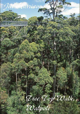
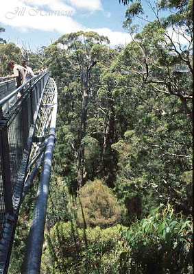
The major attraction of the Walpole Nornalup National Park is the Valley of the Giants and the Tree Top Walk. The 600 metre walkway through the forest canopy reaches 40 metres above the forest floor, providing a unique opportunity to view the Tingle and Kari forest from the tree tops.

From Life Images by Jill

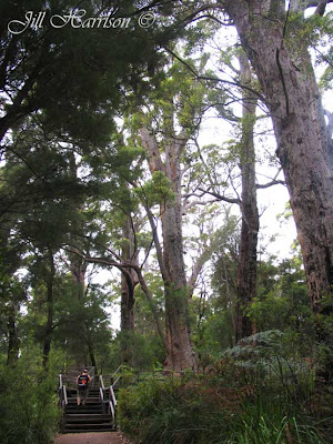
At ground level the Ancient Empire walk winds through the forest around trees 16 metres in diameter. Accessible to wheel chairs, the walks were built to protect the forests and to enhance the experience of the increasing number of visitors without causing an adverse impact on the trees. During school holidays visitors can also experience ‘Forest By Night’ guided walks.

From Life Images by Jill

There are seven national parks within the Walpole Wilderness area. The southern forests, which protect around 2500 species of native flora form an important component of an international biodiversity hotspot. The Walpole Wilderness Discovery Centre Loop is a 98 kilometre (sealed and gravel) drive which includes Mount Frankland, The Valley of the Giants and the Swarbrick Forest Art Trail eight kilometres north of Walpole.

In the photo below, you can see the Wilderness Wall of Perceptions. The 500 metre wheel chair friendly loop walk trail at Swarbrick takes you through some of Western Australia's oldest old growth karri forest dotted with art exhibits and past the giant 39 metre long “Wilderness Wall of Perceptions” which reflects the forest and has etched on it written thoughts about the forest and conservation.

From Life Images by Jill
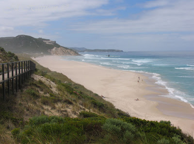
Twelve kilometres west of Walpole is the turnoff to Mandalay Beach which takes its name from the Norwegian ship “Mandalay”, wrecked here in 1911. It is a rugged piece of coastline, and the beach is not safe for swimming, but on low tide the remains of the ship can sometimes still be seen. If you are travelling by 4WD you can camp nearby at Banksia camp, or I recommend camping at the shaded and well protected Crystal Springs campsite at the Mandalay Beach turnoff from the highway.

From Life Images by Jill
Thank you for coming along on the tour everyone, and for taking a look at my photos. I hope you have enjoyed this leg -
Another one from the Treetop walk in the Valley of the Giants....

From Life Images by Jill

From Life Images by Jill
Going down onto Mandalay Beach......

From Life Images by Jill

How about we enjoy some simple pleasures like building sandcastles.........

From Life Images by Jill

Here is another photo - this is the Bibbulmun Track marker where the track goes down to Mandalay Beach - and comes to the coast for the first time since leaving Perth. (you can see some other parts of the track in the Collie thread Week 5, and Balingup week 12)

From Life Images by Jill

Friday, March 19, 2010

Week 12/52 - Balingup - rolling hills, pathways & towering forest

Welcome everyone to Week 12 of our 52 week tour Downunder Western Australia.

I hope you have been enjoying it so far. This week we move on from Nannup and travel eastward to Balingup. Balingup attractively sits within the Blackwood River valley surrounded by rolling green farmland, edged by towering forests. It is a favoured retreat for artisans and craftspeople.

Balingup is also one of the Bibbulmun Track's "track towns". You remember we first went on the Bibbulmun Track in Week 5 near Collie. (it is WA's longest walking track - over 900 kilometres from Perth to Albany) This week we walk another section through a pine forest to the Blackwood hut.

In the photo below you can see us the track through the pine forest. I like the perspective of this shot with the tree lined avenue and the hiker (my husband - again a token person in my photos) and the bright orange backpack.

From Life Images by Jill

I had a bit of difficultly with the contrast in this photo - my husband was standing in shade, but I wanted to show you the scene from near the Blackwood hut.

From Life Images by Jill

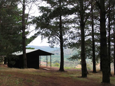
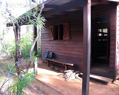
Here is the overnight Blackwood hut, nestled at the edge of the pine forest overlooking the valley. A stunning view. The hut is open on one side to the view and set up with wooden benches and sleeps about 8 people. You need to bring everything - a self inflatable mattress and a really warm sleeping bag is a must - but just imagine laying there in the morning and watching the sun come up and the mist rise up through the valley. Stunning.

From Life Images by Jill
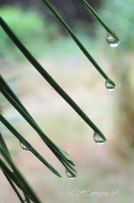
It started to rain on our way back from the hut. But even when it is raining you can still find something to photograph....

From Life Images by Jill

Here is another couple of shots from along the track. This one again was a tricky situation with light on the rolling hills in the background and shadow amongst the trees where we were walking. It is a bit hard to see, but those little dots on the hills in the background are hay bales.

From Life Images by Jill
And some wildflowers - this one is clematis (old man's beard) -

From Life Images by Jill
another one of our more unusual orchids - and very hard to see - the Midge Orchid -

From Life Images by Jill

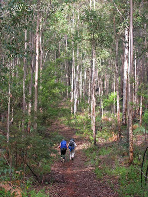
A bit further along the track south of the Blackwood Hut - again some tricky lighting - I like the perspective of the hikers (two of my friends) amongst the trees. We were coming down from a rise in the track and I just had to stop and take some photos.  I did an overnight hike with my friends. Bernard walked all the way from Perth to Albany - over 900 kilometres - and now can proudly call himself an "end to ender".

From Life Images by Jill


Friday, March 12, 2010

Week 11/52 - Bushwalking in Nannup

Welcome to Week 11 of my 52 week tour of Western Australia. This week we head north from our last stop Pemberton, and travel to Nannup.

I hope you have your hiking boots on because we are going for a walk on the Old Timberline Trail in the St John Brook Conservation Park just out of Nannup.

Once echoing with the sounds of axes, saws and timber trains, birdsong now breaks the silence and the jarrah trees have reclaimed their land in an area which was once a major timber logging area.

The Old Timberline Trail is a moderately easy 20 kilometre walk and cycle trail through the Park following the disused forestry railway between Nannup and Cambray Siding. Wood fired locomotives once hauled jarrah along an extensive railway network from bush camps to Barrabup Mill and then to Busselton Jetty for export. Interpretive signs give a historical insight and describe the life of the timber cutters. Most of the railway sleepers have been removed but a few can still be seen along the trail.

Marked by white triangular signs displaying an axe, the trail can be broken into sections making it ideal for day or overnight walks. Starting from the old railway bridge in Nannup, it is 10 kilometres to Workman’s Pool camping area and then 1.2 kilometres to Barrabup Pool. The timber mill and townsite which operated between 1909 and 1925 were located in this area.

The picnic area and platform overlooking Barrabup Pool invites you to linger. From here it is 4 kilometres to Sleeper Hewer’s camp where there is an overnight hut and then 4.8 kilometres to Cambray Siding. Here is a photo of Barrabup Pool.


From Life Images by Jill
Leaving Barrabup Pool, a bridge crosses St John Brook before the trail climbs up to join the old railway track. Along the way is the Potato Swamp where vegetables were once grown for the Barrabup community.

Dominated by jarrah, banksia and a profusion of wildflowers in spring, the trail follows the ridge line above the brook with glimpses of the water through the trees.

From Life Images by Jill

The trail descends to the remains of a disused timber railway bridge spanning the gully. We stayed for a while to take some photos of the bridge. I've converted this one to black and white.

From Life Images by Jill

A short walk through a rail cutting leads to Sleeper Hewer’s Camp (4km). Set above two wide pools of the river it is a tranquil place for lunch or an overnight stop and an opportunity to observe the many birds and animals that inhabit the Park.

From Life Images by Jill

From the hut it is easy walking from here to Cambray Siding where men who repaired the railway lines once lived. Observant walkers may see native orchids at the edge of the trail.

A few minutes later you reach the car park and the intersection with the 26 kilometre Jarrahwood to Nannup Sidings Rail Trail. It is 15 kilometres from here back to Nannup along the Sidings Trail.


And a few wildflowers - can't go bushwalking without photographing wildflowers........

Banded Greenhood Orchid..........

From Life Images by Jill
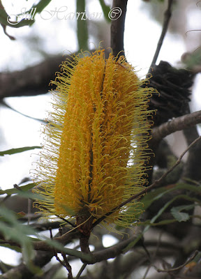
Banksia..........

From Life Images by Jill
Dryandra.........

From Life Images by Jill

....oh and, we decided it was too cold to camp out in a hut, so here is the veranda of our accommodation for the night. Fancy a wine and cheese platter and a hot spa to soak those tired feet? This cottage is on a farming property just out of Nannup and bounded on two sides by the river and the bush. We have stayed here twice - it is lovely.

From Life Images by Jill

Friday, March 5, 2010

Week 10/52 - Karri camping, Pemberton, Western Australia

Welcome to Week 10 of our 52 week tour around Western Australia.

This week we move away from the coast and go inland to camp on the banks of the Warren River amongst the towering Karri trees of the Warren National Park just south of Pemberton, Western Australia. It’s only a few hours drive to get here from our home in Bunbury, but we could be thousands of miles from anywhere, it is so utterly peaceful.

Pemberton is an all year round destination set deep in the Karri forest of the spectacular Southern Forests region 335 kilometres from Perth. It is an ideal central base from which to explore all that the south west corner of Western Australia has to offer.

First settled in1861 by Edward Brockman (son of Perth’s first mayor, one of the original Swan River Colony settlers) and his wife Capel Bussell (daughter of John Bussell, the original Busselton settler), Pemberton was established as a milling town in 1913 with an order to supply half a million railway sleepers for the Trans-Australian Railway.

Today Pemberton’s tourism centres around its forests. If you enjoy bushwalking there are many walk trails in the five National Parks that are in close proximity to Pemberton - Gloucester, Warren, Beedelup, D’Entrecasteaux and Shannon. Scenic drives, canoeing, fishing and 4 wheel driving are also on the agenda, and for a change of pace there are a growing number of artist galleries, wineries, and restaurants specialising in fresh home grown produce. Or try your hand a fly fishing at the Trout and Marron farm.

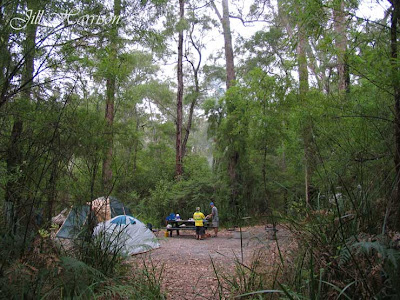
Here is a photo of our camp for the next few nights. You can see my husband Rod and son Mark getting our breakfast ready.

 
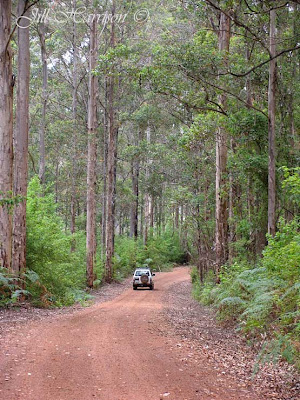
Here we are driving through the spectacular towering Karri forests. Western Australia’s southern forests are dominated by Karri trees which grow only in WA’s wettest corner. Belonging to the eucalypt family, many of the South West’s Karri trees are over 400 years old and reach a maximum height of about 90 metres making them one of the tallest forest trees in the world. The Karri has a long straight trunk with smooth bark which changes colour as it matures and which it sheds each year. Interspersed with the Karri are Tingles, Jarrah, Marri, Bullich and Blackbutt and a stunning display of over 1500 wildflower species from September to November.
 

In Pemberton there are many ways to enjoy the Karri forests. The most popular is to climb the Gloucester Tree, just three kilometres from Pemberton or the Dave Evans Bicentennial Tree in the Warren National Park. Gloucester Tree is one of eight lookout trees built between 1937 and 1952 for spotting fires in the forest, whilst the Bicentennial was pegged in 1988 as part of the Bicentennial celebrations. Thousands of visitors go here every year to climb to the viewing platforms and experience the spectacular views above the canopy. The lookout at Gloucester Tree is about 60 metres off the ground, while the Bicentennial lookout is more than 60 metres high, making it the highest treetop lookout in the world.

Here is a photo taken during our climb up Bicentennial Tree.

 
To really appreciate the forests, the Department of Environment and Conservation booklet “Pemberton Bushwalks” describes the great array of walk trails around Pemberton, including Beedelup National Park and Beedelup Falls, Big Brook Dam and Arboretum, Gloucester National Park, the Cascades, and Yeagerup Dunes, as well as walks at Northcliffe and Shannon. These walks allow you to be completely absorbed by the tranquillity, scents and sounds of the forest and can be enjoyed all year round.

Here is a photo of Lefroy Brook near the Cascades.


Here we are at beautiful Big Brook Dam just out of Pemberton. There is a walk track that is wheel chair friendly which goes right round the dam, a picnic area, and swimming beach (you can see the swimming beach and picnic area just there on the left hand side of the photo). Lovely on a hot summers day to cool off, and beautiful in spring to see the wildflowers. There are also bird hides around the dam from where you can observe the water birds.

 
This wildflower is call Clematis.
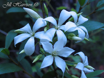
Clematis

This is the slipper orchid, which we found along a walk trail along the Warren River near our camp site.
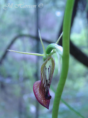
Slipper Orchid

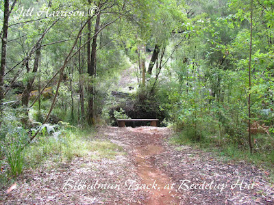
After a day bushwalking, what a lovely place to sit by the river. This is at the Bibbulmun Track hut at Beedelup, not far from Pemberton. Pemberton is one of the "Track towns" of the Bibbulmum (walking) Track which goes from Perth to Albany.

 
From the Karri forests of Pemberton we drive south to the Yeagarup Dune system within the D'Entrecasteaux National Park on the south coast of Western Australia. Major rivers including the Warren, Donnelly and Shannon, drain through D'Entrecasteaux and empty into the Southern Ocean through here. High sand dunes and limestone cliffs on the sea coast give way to coastal heathlands and a series of lakes and swamps further inland.

One of its outstanding features is Yeagarup Dune, an impressive mobile dune 10 kilomtres long. The coastal winds whip the white sands into mobile dunes, which are constantly on the move - relentlessly moving forward covering lakes and overtaking forests in their path. The face of the dune is over 40 metres high. It is an amazing sight.
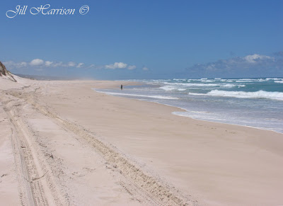
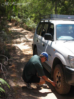
You need to lower your tyre pressures before tackling the four wheel drive track which takes you through Banksia tree woodlands, and past the Yeagarup Lake and Naenup swamp to the base of the sand dune. Once on the dune, follow the markers which show you the track across the dunes to the beach - about 8 kilometres.

 
In this photo you can see the face of the dune and how it is overtaking the woodland. The 4 wheel drive track moves over as the dune takes it over.


On top of the dune looking to the north away from the coast.

 
Here we are in sight of the coast.

 
For the fishermen amongst you, here is another, taken along Yeagarup Beach.